by Barani Chettiar | Aug 28, 2023 | Uncategorized
4 Factors That Affect the Range of Your Marine VHF at Sea
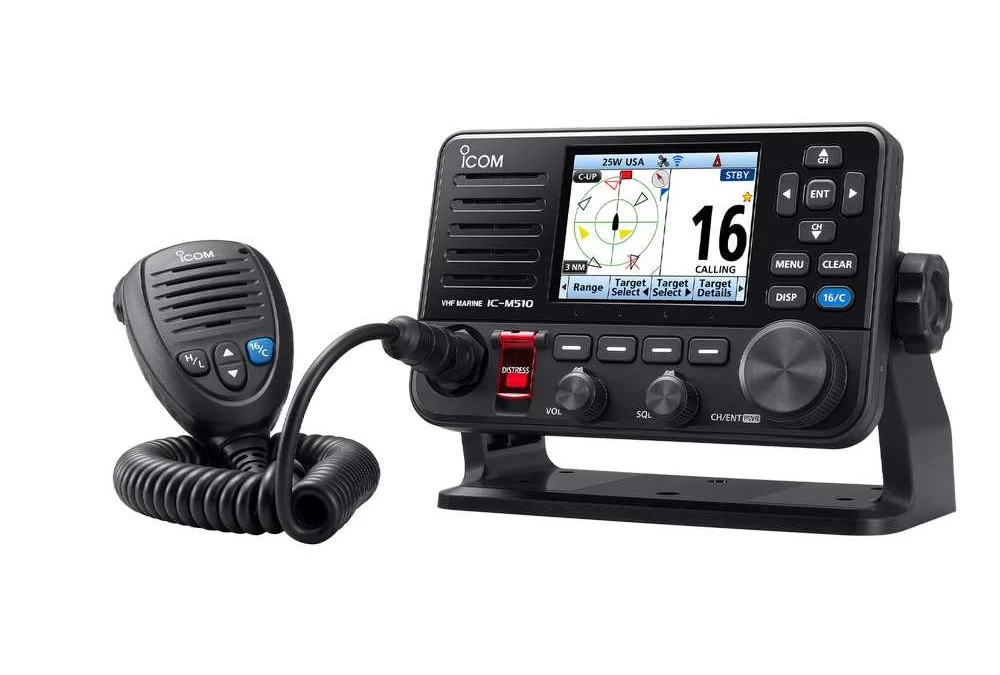
Marine VHF (Very High Frequency) radios have assumed an indispensable role as integral devices in seafaring journeys, offering various benefits for anglers, sailors, and boaters alike. These radios facilitate real-time information exchange between vessels and shoreside authorities, enabling swift responses to emergencies, accidents, and distress signals. Moreover, mariners can receive up-to-date weather forecasts, navigational warnings, and other crucial information that aids in informed decision-making during their voyages. They also serve as a pivotal tool for seamless coordination among vessels sharing waterways, thereby reducing the risk of collisions and misunderstandings.
Nevertheless, despite the capabilities of marine VHF radios, various factors still influence their range during maritime voyages. A comprehensive understanding of these influencing factors is pivotal for ensuring the efficiency and reliability of maritime operations. Here, we delve into the distinct factors that can impact the frequency and range of your marine VHF radio as you navigate through the vast expanse of waters:
1. Transmitter Power
Marine VHF radios use frequencies between 156 and 164 MHz as defined by the International Telecommunications Union. Moreover, they are only allowed to transmit a maximum of 25 watts to allow vessels far away to communicate using the given frequencies. With this, you must know the transmission power to use when communicating with stations or other vessels from a certain distance. The strategic optimisation of transmitter power is pivotal for effective maritime communication.
2. Intervening Topographical Features
Generally, a VHF signal must travel in a straight line between points, which is a characteristic that is referred to as “line of sight.” Therefore, topographical structures such as islands, cliffs, and other geographical features can potentially impede VHF signals, leading to reduced communication ranges. To ensure these structures do not impede your communication range, you must appropriately position your marine VHF radio antennas. At the same time, you must have a clear line of sight with the vessel or station you are communicating with to ensure successful transmission.
3. Antenna Height
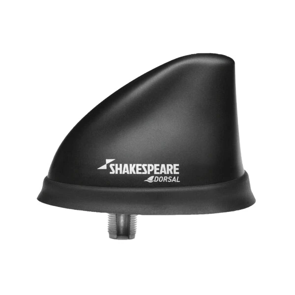
Elevating your VHF antenna can significantly amplify the reach of the radio signal. Installing your antenna at an ample height on your vessel allows a clearer line of sight between communication devices. Therefore, it reduces the impact of obstructions and enhances signal propagation. Moreover, most marine VHF antennas are designed with vertical polarisation, performing best when mounted perfectly vertically. When the angle is beyond vertical, the performance of your radio signal is reduced.
4. Atmospheric Conditions
Variations in weather conditions and ionospheric activity can significantly influence the reach of marine VHF communication. Weather phenomena like thunderstorms, precipitation, and atmospheric turbulence can attenuate radio signals, limiting their range. Furthermore, ionospheric fluctuations can alter the path of radio waves, impacting their ability to travel long distances. For example, when the temperature rises, it results in a refractive effect between the warm layer of the atmosphere and the earth’s surface. With this, the radio waves bounce back to the earth, greatly increasing the VHF radio’s communication range. Understanding and adapting to these atmospheric dynamics is essential for maintaining consistent and dependable VHF communication under diverse conditions. You can also learn more about marine safety tips during rough sea conditions.
Get High-Quality Marine VHF in Singapore at Tecomart
We know how essential marine VHF radios are in marine communication and safety. As a leading name in radio communication equipment suppliers in Singapore, Tecomart offers a diverse range of marine VHF radios and accessories. We have fixed-mount marine VHF devices from reputable transmitting and receiving equipment manufacturers, such as Shakespeare Marine, ICOM, and JRC. With this, we strive to empower you to maximise your communication range and enjoy your maritime journeys to the fullest.
Whether you’re looking for a reliable VHF marine radio for sale or VHF antennas, Tecomart is your trusted partner. Our commitment to providing quality equipment and customer satisfaction ensures you have everything you need to explore the seas safely and confidently. Browse through our catalogue to find quality marine navigation and communication equipment for your next sea voyage today.
by Barani Chettiar | Jul 19, 2023 | Uncategorized
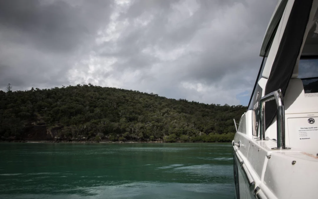
Rough sea conditions can be unpredictable and pose significant challenges for amateur fishermen with shipping vessels. However, there are signs to watch for that indicate the presence of challenging weather. Understanding this lets you act immediately to ensure the safety of your crew during your voyage or enables you to decide whether or not you should delay your trip. With this, we give you insight into the rough weather conditions you must watch out for and tips on navigating through them if you are at sea safely.
Identifying and Monitoring Rough Sea Conditions
Pay attention to these indicators, so you can make informed decisions to ensure your safety before or during rough sea conditions:
- Swells and Wave Patterns:Keep an eye out for unusually large or steep waves, as well as rapid changes in wave direction or height. These can be signs of rough seas. When waves become more aggressive and irregular, it’s an indication that the sea conditions are deteriorating. Familiarise yourself with the typical wave patterns in your region, so you can recognise when they deviate significantly from the norm.
- Wind Speed and Direction: Strong winds have a direct impact on sea conditions. Higher wind speeds can create rough seas by generating larger waves and increasing their frequency. Monitor the wind speed and direction using reliable weather forecasting services or onboard anemometers. Be aware that wind patterns can change quickly, so regularly check for updates throughout your journey.
- Cloud Patterns:Clouds can provide valuable information about imminent weather changes. Dark, menacing clouds or a sudden increase in cloud cover can signify an approaching storm. Pay attention to the cloud formations and their movement. If you notice dark, towering cumulonimbus clouds or a gathering of low, thick clouds, it’s a strong indication that rough sea conditions may be on the horizon.
- Barometric Pressure: Barometric pressure refers to the atmospheric pressure at sea level. Falling barometric pressure often indicates deteriorating weather conditions, including rough seas. Keep a barometer on board to monitor changes in pressure. If you observe a rapid decrease in barometric pressure, it suggests the approach of a low-pressure system, which typically brings unsettled weather and rough seas. Be prepared for challenging conditions when the barometric pressure drops significantly.
Ensuring Safe Navigation in Rough Seas
When facing rough sea conditions, thorough voyage preparation, proper navigation techniques, and marine equipment are essential for safe passage. Here are some vital tips to help you navigate through challenging waters:
Preparation for Rough Seas
Before setting sail, you must be prepared for emergency situations, even when the weather is clear. Here is how you and your crew can prepare for rough seas to ensure your safety:
- Check Weather Forecasts:Before setting sail, stay updated with reliable weather forecasts specific to your intended navigation area. Pay close attention to storm warnings or advisories that may indicate rough sea conditions. Choose reputable weather forecasting services and consult multiple sources to obtain a comprehensive understanding of the expected weather patterns.
- Safety Equipment:Ensure that your vessel is equipped with the necessary safety gear to handle rough seas. Life jackets should be readily available and properly fitted for all crew members. Additionally, stock your vessel with distress signals, such as flares or an emergency beacon, to alert others in case of an emergency. Fire extinguishers should also be in good working condition and easily accessible.
- Secure Loose Items:Before encountering rough seas, secure all loose equipment and personal belongings on your vessel. Unsecured items can become hazardous projectiles or cause injury during rough conditions. Secure equipment in storage compartments, stow loose items in designated areas and use appropriate fasteners or straps to prevent them from moving or shifting.
- Emergency Plans: Establish clear emergency plans and communicate them to all crew members before embarking on your voyage. Conduct drills to ensure everyone is familiar with emergency procedures, such as man overboard protocols and distress signal usage. Assign specific roles and responsibilities to each crew member to ensure a coordinated response in case of an emergency.
Proper Navigation Techniques
When you are on a nautical voyage and you encounter rough seas along the way, you must be aware of the proper navigation techniques to keep you, your crew, and your vessel safe. Here are the proper navigation techniques when you are sailing through rough seas:
- Reduce Speed: When encountering rough seas, it’s crucial to slow down your vessel to maintain stability and control. Reduce your speed to a level that allows you to navigate safely through rough conditions. By decreasing your speed, you can reduce the impact of waves and enhance your ability to respond to changes in sea conditions effectively.
- Maintain a Steady Course: Avoid making abrupt changes in course or heading, as they can increase the risk of capsizing or losing control of your vessel. Instead, navigate with smooth and gradual manoeuvres, keeping your vessel on a steady course. This approach helps maintain stability and reduces the chances of encountering dangerous wave angles.
- Trim the Boat:Properly adjusting the trim of your vessel is crucial for optimal stability in rough seas. Trim refers to the distribution of weight and balance on the boat. Adjust the trim by shifting weight or using trim tabs, if available, to ensure that the vessel remains balanced and rides the waves more smoothly. Experiment with different trim settings to find the most stable configuration for your vessel.
- Use Ballast or Weight Distribution: Distribute the weight evenly across your vessel to maintain stability and minimise the impact of rough sea conditions. If your vessel allows, adjust the ballast or distribute the weight from one side to the other to maintain a balanced stance. Proper weight distribution helps to prevent excessive rolling or pitching motions, ensuring better control over your vessel.
Marine Equipment to Use
When navigating through rough seas, having the right equipment is crucial for ensuring safe and effective communication and navigation. Here are some essential marine equipment recommendations.
Radio Communication Equipment
- Marine VHF Radio: Marine Very High Frequency (VHF) radios are the standard communication devices for maritime use. They provide reliable short-range communication with other vessels and shore stations. Invest in a high-quality marine VHF radio that meets regulatory requirements and has a long operating range.
- Global Maritime Distress and Safety System (GMDSS): GMDSS is an internationally recognised system that enhances safety and distress communication at sea. It includes various communication devices such as emergency position-indicating radio beacons (EPIRBs), search and rescue transponders (SARTs), and digital selective calling (DSC) capabilities on VHF radios.
- AIS Transponders: Automatic identification systems (AIS) transponders play a significant role in marine navigation and safety as they allow for the exchange of vessel information. The information exchanged includes position, speed, and route between nearby vessels and shore stations.
Nautical Navigation Equipment
- GPS Chartplotters: GPS chart plotters combine GPS technology with electronic charts, providing accurate position information, route planning, and real-time tracking. These devices display your vessel’s position on a digital chart, making marine navigation more precise and efficient. Choose a GPS chartplotter that is suitable for your vessel size and navigation needs. Learn more about the importance of GPS navigation.
- Marine Radars: Marine radars use radio waves to detect objects, land masses, and other vessels. They provide valuable information about the distance, bearing, and speed of potential hazards, helping you navigate safely, especially in low visibility conditions or during night-time operations. Buy a marine radar system that offers a wide range of detection and advanced features such as target tracking and collision avoidance.
Get Marine Equipment for Improved Sea Safety
When it comes to navigating rough seas and ensuring the safety of your vessel and crew, having reliable and high-quality marine equipment is paramount. Tecomart is dedicated to providing you with top-notch marine navigation equipment and radio communication equipment that can significantly enhance your safety and make your journey on the open seas more enjoyable. Purchase the marine equipment you need from us today.
by Barani Chettiar | Jun 15, 2023 | Uncategorized
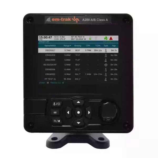
In recent years, the advancement of marine communication and navigation technology has made it easier for seafarers to sail through the seas safely and efficiently. Many tools and devices have emerged over the years that have helped seafarers locate where they are, contact other vessels and ports, prepare for bad weather at sea, and avoid obstacles at sea or collisions. One valuable piece of marine safety equipment is the Automatic Identification System transponder or AIS transponder.
What Is AIS?
An Automated Identification System (AIS) is an automated tracking system that displays other vessels within the area. The AIS transponder automatically transmits dynamic information, such as the ship’s course, speed, and destination; static information, such as the ship’s name and length; and voyage-related information, like cargo information and navigational status. AIS-equipped vessels and shore-based stations will receive and send this identification information, displayed on a computer or chart plotter.
Classes of AIS Transponders
Different types of vessels use either of the two different classes of AIS transponders — Class A AIS transponder and Class B AIS transponder.
Class A AIS Transponder
A Class A AIS transponder is mandated for all vessels 300 GT and above engaged in international voyages and passenger ships. As such, these AIS transponders come with a longer range and greater frequency. They also have advanced features, such as collision avoidance algorithms and the ability to coordinate with other AIS-equipped vessels to send and transmit data.
Class B AIS Transponder
A Class B AIS transponder is primarily designed for smaller vessels, like boats and fishing vessels. They’re a more cost-effective device that still provides the necessary AIS functionality. They can transmit crucial vessel information to other vessels in the vicinity. The information it can send out includes vessel position, speed, and course.
How Can an AIS Transponder Help with Marine Navigation and Safety?
Here are some ways a Class A or Class B AIS transponder can be useful when navigating at sea.
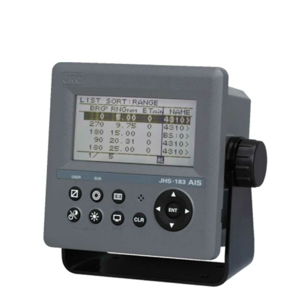
1. Collision Avoidance
When you are out at sea, it can be difficult to anticipate unexpected ship appearances that could cause collisions or risky manoeuvring. However, having an AIS transponder can improve your situational awareness when sailing across the waters. An AIS transponder lets you detect and track other vessels in real time and gives you a comprehensive overview of the maritime traffic in your area. This information can enable you to assess traffic density, identify potential navigational hazards, and carefully decide your vessel’s course and speed.
A Class A AIS transponder that can be good for situational awareness at sea is the JRC JHS-183, as it displays information about AIS-equipped ships and coastal stations. It also outputs AIS data to Electronic Chart Display and Information (ECDIS), radar and other navigational equipment for collision avoidance support.
2. Useful for Search and Rescue Operations
AIS transponders can play a significant role in search and rescue operations by enabling authorities to quickly identify and locate fishing vessels in distress. AIS can be activated to transmit distress alerts and provide vessels, maritime authorities, and rescue coordination centres to immediately initiate a search and rescue (SAR) operation.
Additionally, AIS transponders can contribute to efficient coordination and resource allocation during SAR operations. By receiving AIS data from vessels in distress, rescue coordination centres can assess the situation, identify potential overlaps or gaps in coverage, and allocate resources effectively. This includes dispatching nearby vessels or specialised teams to the precise location of the distressed vessel, reducing response time and increasing the chances of a successful rescue.
3. Improved Marine Navigation Efficiency
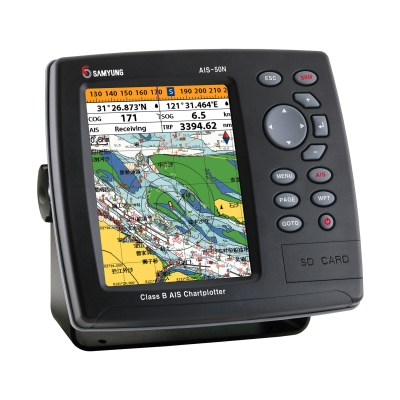 Since the AIS transponder provides accurate and up-to-date information about vessel positions at sea, you can plan your navigation at sea more productively. You can optimise your routes, avoid congested areas, and make more efficient use of your time and resources. An AIS helps you reach your destination more quickly and economically by avoiding unnecessary delays and detours.
If you’re looking for an AIS transponder that will optimise your navigational efficiency, we recommend the ICOM MA-510TR for small vessels. Aside from its AIS functionalities, it comes with a built-in map, GPS antenna with cable, and more. For commercial vessels, the Samyung ENC SI-70A might also be a great fit. It has an easy setup, a built-in map, and auto speed detection and checking of external output.
4. Integration with Other Marine Navigation Systems
You can also seamlessly integrate your AIS transponder with your marine navigation equipment, such as radar, electronic chart plotters, and Automatic Radar Plotting Aids (ARPA). This integration allows for a comprehensive display of vessel positions, combining AIS data with radar and chart information. By integrating multiple systems, you can have a more holistic view of your surroundings, ensuring better decision-making and safer navigation.
Get Your Marine Communication & Navigation Equipment at Tecomart
When it comes to marine communication and navigation equipment in Singapore, you can trust Tecomart to have the tools and devices you will need. We have a wide selection of quality Class A and Class B AIS transponders that can help you send and receive vessel information to other AIS-enabled vessels so that you can improve navigation and safety at sea. You can find equipment from reputable brands, such as Em-Trak, Samyung ENC, FURUNO, and more.
We also provide other devices that can help you on your next sea voyage, such as radio communication equipment, marine radars, and GPS chart plotters, among others. Learn more about what you need or how you can prepare to stay safe on your next voyage at sea when you check out our five basic marine safety tips for vessels. Should you want to know more about the products we offer, feel free to contact us today.
by Barani Chettiar | May 25, 2023 | Uncategorized
To navigate the vast seas, you must have the right marine navigation equipment with you. An indispensable nautical navigational device you will need is the GPS. The GPS has revolutionised how ships navigate vast waters by providing accurate positioning information. In this blog, we explore the significance of GPS navigation at sea and its numerous benefits for commercial and amateur fishers or seafarers.
What Is a GPS and How Does It Work in Marine Navigation?
Essentially, a global positioning system (GPS) is a network of satellites and receiving devices used to identify the location of a vessel at sea. These satellites continuously transmit signals that GPS receivers onboard ships will receive. A GPS receiver can determine its precise location, speed, and time by triangulating signals from multiple satellites. This information is displayed on electronic navigation systems, enabling seafarers to sail through accurately and confidently.
The Benefits of Using GPS in Marine Navigation
As GPS gives you all the information you need to identify your location and find the best possible route, it ultimately leads to other benefits, including:
1. Enhanced speed and efficiency
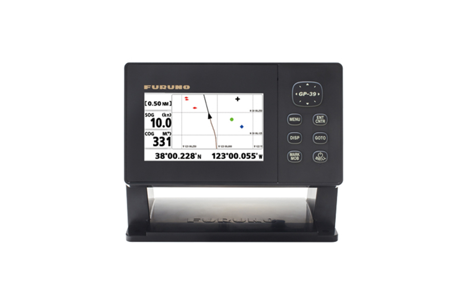 When you need to be at a specific port at a certain time, a GPS makes it easier for you to determine the best possible route to take. Using a GPS allows you to consider different factors, such as currents, tides, and weather conditions when choosing the right course to your destination. It ultimately helps you confidently navigate through narrow channels, intricate coastlines, and even congested ports efficiently. If you’re looking for a GPS chart plotter that can help you go sail to your destination efficiently, then the Element Series from Raymarine can be a great choice.
2. Improved safety at sea
 One of the most critical aspects of maritime navigation is ensuring the safety of the vessel and crew. GPS plays a pivotal role in enhancing safety at sea and having a reliable GPS is one of the top safety tips for any marine vessel. With real-time positioning information, ships can navigate with greater awareness and make informed decisions to avoid hazards. GPS allows sailors to steer clear of reefs, sandbars, and submerged objects that can cause grounding or damage to the vessel. It also aids in identifying and avoiding areas with strong currents or adverse weather conditions, reducing the risk of accidents and ensuring a safer voyage.
Nowadays, seafarers have marine equipment that combines navigation and communication in the form of an AIS transponder. There are modern AIS transponders that combine GPS technology and radio communication, enabling ships to exchange vital information, such as position, speed, and course. This real-time data allows ships to detect collisions early so that they can take proactive measures to avoid accidents and safeguard their crew.
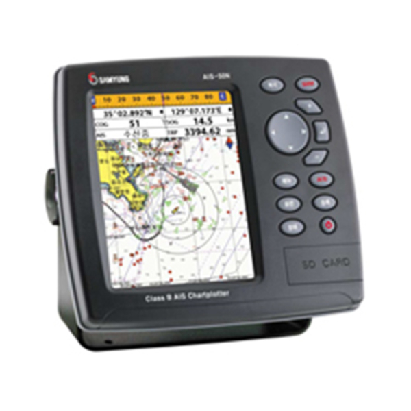
An AIS transponder that comes with its own GPS technology is the AIS-50N from Samyung ENC. It’s a Class B AIS transponder that comes with a real-time display of navigation information, preloaded digital worldwide map cartography, and a cursor ID mode that allows easy readout of the target vessel. Learn more about the different classes of AIS transponders so you can find the right one for your vessel.
3. Reduce fuel consumption
Using GPS for navigation can reduce fuel consumption and limit costs by plotting the most efficient routes to the destination and avoiding unnecessary detours. To limit the time spent at sea and fuel used to get to your destination, a GPS can help you can take advantage of favourable currents and winds, as well as avoid congested shipping ports or busy shipping lanes with ease. Furthermore, having an accurate arrival time with the help of a GPS can enable you to reduce the need to maintain high speeds and waste fuel unnecessarily.
Get Your Marine Navigation Equipment from Tecomart
When it comes to trusted GPS equipment or other marine navigation equipment, you can trust that Tecomart has what you need. We are a trusted supplier of well-known marine navigation and communication equipment with a catalogue of tools and devices from brands, such as ICOM, SIMRAD, and SAMYUNG ENC. Browse through our broad list of marine equipment and get all you need for your next voyage at sea. To know more about the products we provide, please reach out to us.
by Barani Chettiar | Apr 27, 2023 | Uncategorized
In any voyage out into the sea, you must always have an emergency plan prepared. That way, when an unforeseen circumstance occurs, you will always be prepared to handle it and equipped with the right equipment. Training and practical drills are a great way to effectively learn how to handle any emergency at sea.
However, if you’re still starting and want to learn the basics of tackling emergencies efficiently, then here’s a brief guide on how to do so:
1. Stay Calm And Assess The Situation
You must stay calm in any emergency at sea to assess the situation. When you panic, it can lead to poor decision-making, causing harm to you and the people around you. If you’re feeling tense, take a few deep breaths and evaluate your surroundings before taking action. That way, you can effectively carry out your emergency plans for the specific situation.
2. Follow Emergency Procedures
Ensure you and everyone on board follow the procedures outlined in your plan, including calling for help through flares, visual signals, or radio communication equipment, deploying life rafts or even using fire extinguishers. The proper procedure must be carried out to ensure the safety of everyone onboard.
3. Always Wear Life Jackets
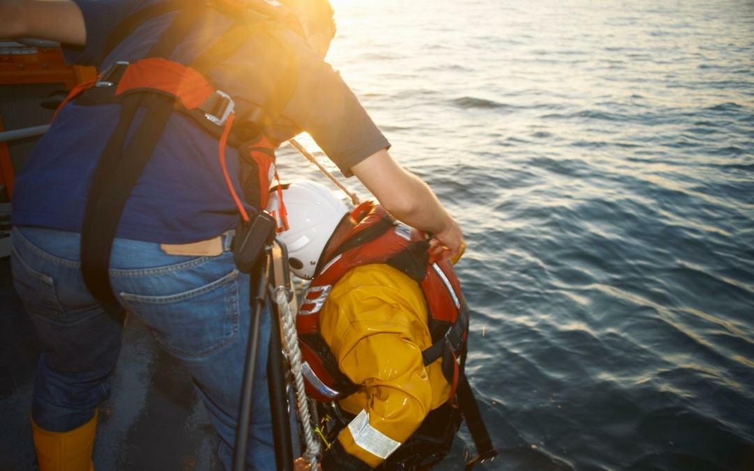
One of the most important safety measures when boating is having a life jacket onboard at all times, whether you or anyone else onboard knows how to swim. You must have a life jacket that properly fits each person on the boat. When an emergency at sea arises where everyone has to leave the boat, ensure that you and everyone onboard wear a life jacket at all times, especially when you have to be on the water.
4. Know Your Location And Put Your Emergency Navigation Plan Into Action
In times of emergency, you must be aware of your location and the potential hazards that could put you and your vessel at even more risk. Therefore, you should have an emergency navigation plan and marine navigation equipment. One of the most essential navigation equipment to have is a marine radar, which helps you detect other vessels, avoid obstacles, navigate in poor visibility, and even track weather conditions. Marine radar is useful in any emergency at sea since it provides your location in real-time, making it easier for the coastguard or nearby vessels to find you and provide assistance.
If you’re looking for marine radars for sale from reputable brands like Garmin and Furuno, you can find what you need at Tecomart.
5. Have a Way to Communicate Your Emergency
Before going out into the sea, you must always have marine communication equipment on the boat, like radio communication devices. If you have a small vessel, you can opt for a handheld VHF marine radio, like the ICOM IC-M37 or the Standard Horizon HX-300. Medium-sized vessels can opt for fix-mounted marine VHF devices. You can learn more about marine VHF and why it’s necessary for your vessel when you check out our previous blog. Having flares and visual signals can also help when you need the coast guard or other vessels to locate you when you are in distress.
When making a distress call on your VHF marine radio during emergencies, the call should include “Mayday!” followed by the name of your vessel, your location, and a brief description of your emergency. Stay on your radio and wait for the coastguard or other vessels to respond.
Get Your Radio Communication Equipment from Tecomart
One of the basics to marine safety for any vessel is to have an emergency safety plan. You must always be prepared for any emergency while boating at sea. Besides training and planning procedures for any emergency, you must also have the right marine equipment with you. Tecomart has what you need to navigate and communicate at sea. We have VHF marine radios, handheld VHF radios, and marine radars for sale, all from trusted marine navigation and radio communication suppliers. Feel free to contact us today to learn more.


 Since the AIS transponder provides accurate and up-to-date information about vessel positions at sea, you can plan your navigation at sea more productively. You can optimise your routes, avoid congested areas, and make more efficient use of your time and resources. An AIS helps you reach your destination more quickly and economically by avoiding unnecessary delays and detours.
If you’re looking for an AIS transponder that will optimise your navigational efficiency, we recommend the
 When you need to be at a specific port at a certain time, a GPS makes it easier for you to determine the best possible route to take. Using a GPS allows you to consider different factors, such as currents, tides, and weather conditions when choosing the right course to your destination. It ultimately helps you confidently navigate through narrow channels, intricate coastlines, and even congested ports efficiently. If you’re looking for a
  One of the most critical aspects of maritime navigation is ensuring the safety of the vessel and crew. GPS plays a pivotal role in enhancing safety at sea and having a reliable GPS is one of the