by Barani Chettiar | Apr 2, 2024 | Uncategorized
Importance of Navigational Tools for Fishermen
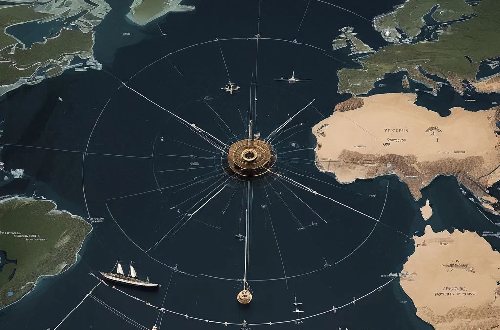
For commercial fishermen, navigating the open waters is not just a matter of reaching a destination but also about ensuring safety, maximizing efficiency, and optimizing catch opportunities. In this blog, we’ll explore the essential navigational tools that are indispensable for commercial fishermen, helping them navigate, locate fish, monitor weather conditions, and ensure a successful fishing expedition.
GPS Systems: Key Features and Benefits
Global Positioning System (GPS) technology has revolutionized marine navigation, providing accurate positioning information and navigation aids for fishermen. GPS systems offer key features such as:
Precise Positioning: GPS provides accurate latitude and longitude coordinates, enabling fishermen to pinpoint their exact location on the water.
Waypoint Marking: Fishermen can mark waypoints to record productive fishing spots, navigational hazards, or points of interest for future reference.
Route Planning: GPS allows fishermen to plan and navigate routes, set waypoints, and create tracks to follow predefined paths with ease.
Emergency Position Indicating: In case of emergencies, GPS-equipped devices can transmit distress signals with accurate position information to facilitate swift rescue operations.
Fish Finders: How They Enhance Fishing Efficiency
Fish finders, also known as depth sounders or sonar devices, are invaluable tools for commercial fishermen, helping them locate fish and assess underwater topography. Fish finders offer several benefits, including:
Detection of Fish Schools: Fish finders use sonar technology to detect fish schools, individual fish, and underwater structures, allowing fishermen to target productive fishing areas.
Depth Measurement: Fishermen can accurately measure water depth, identify depth changes, and locate underwater features such as drop-offs, reefs, and channels where fish tend to congregate.
Bottom Composition Analysis: Fish finders can provide information about the composition of the seafloor, helping fishermen identify suitable fishing grounds and avoid rocky or debris-laden areas.
Radar Technology: Enhancing Safety at Sea
Radar technology is essential for ensuring safety at sea by providing real-time information about surrounding vessels, navigational hazards, and adverse weather conditions. Radar systems offer the following benefits:
Collision Avoidance: Radar enables fishermen to detect and track nearby vessels, navigate safely through congested waterways, and avoid collisions by maintaining situational awareness.
Weather Monitoring: Radar can detect approaching weather systems, such as storms, squalls, and fog banks, allowing fishermen to take proactive measures to navigate around hazardous weather conditions.
Navigation in Low Visibility: In poor visibility conditions, such as darkness or fog, radar provides essential navigational assistance by detecting landmarks, buoys, and other navigational aids.
Electronic Charts: Detailed Mapping for Navigation
Electronic charts, also known as electronic navigation charts (ENCs) or digital charts, provide detailed mapping and navigational information for commercial fishermen. Electronic charts offer several advantages, including:
Comprehensive Coverage: Electronic charts provide comprehensive coverage of waterways, including detailed information about depths, currents, navigational aids, and hazards.
Customization Options: Fishermen can customize electronic charts by overlaying additional information, such as fishing hotspots, navigational routes, and environmental data, to tailor the charts to their specific needs.
Real-Time Updates: Electronic charts can be updated in real-time to reflect changes in navigational conditions, ensuring that fishermen have access to the latest information for safe and efficient navigation.
Weather Forecasting Tools: Monitoring Conditions for Safety
Weather forecasting tools are essential for commercial fishermen to monitor weather conditions and make informed decisions about when and where to fish. These tools offer the following benefits:
Accurate Weather Predictions: Weather forecasting tools provide accurate forecasts of wind, waves, precipitation, and other meteorological parameters, allowing fishermen to plan their fishing trips accordingly.
Safety Precautions: By monitoring weather conditions in advance, fishermen can take appropriate safety precautions, such as delaying departure, seeking shelter, or returning to port, to avoid exposure to hazardous weather conditions.
Fishing Strategy Optimization: Weather forecasting tools enable fishermen to optimize their fishing strategies by targeting favorable weather conditions that are conducive to successful fishing, such as calm seas, stable atmospheric pressure, and moderate winds.
Emphasizing the Importance of Using These Tools
In conclusion, navigational tools are indispensable for commercial fishermen, providing essential assistance in navigation, fish detection, safety, and weather monitoring. By leveraging GPS systems, fish finders, radar technology, electronic charts, and weather forecasting tools, fishermen can enhance their efficiency, safety, and success on the water. Investing in and utilizing these essential navigational tools is crucial for ensuring a productive and safe fishing experience in the challenging marine environment.
by Barani Chettiar | Apr 1, 2024 | Uncategorized
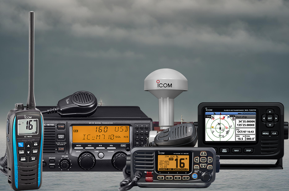
Ahoy, maritime enthusiasts! As you embark on the open waters, the importance of reliable communication cannot be overstated. In the ever-evolving world of marine technology, a vessel’s lifeline is often a trusty radio system. Join us on this nautical journey as we explore the diverse array of marine radios that keep commercial vessels connected, informed, and safe.
VHF Radios: Standard Communication Equipment on Boats
you’re navigating coastal waters, surrounded by seagulls and the gentle lapping of waves. In such scenarios, the VHF (Very High Frequency) radio is your steadfast companion. Standard issue on boats, VHF radios are the go-to for short-range communication. Whether coordinating with nearby vessels, contacting harbourmasters, or reporting the catch of the day, these radios ensure crisp and clear communication, making them the backbone of maritime chatter.
MF/HF Radios: Long-Distance Communication in Open Seas
Now, let’s set sail into the vastness of the open seas. When you’re far from the coastline, VHF might not cut it. Cue the MF/HF (Medium Frequency/High Frequency) radios, designed for long-distance communication. These robust radios transcend the limitations of VHF, ensuring that even in the remotest parts of the ocean, your messages can traverse the waves and reach the intended recipients. Perfect for offshore adventures and deep-sea explorations, these radios are the sea captain’s choice for staying in touch when coastlines fade into the horizon.
Satellite Phones: Global Coverage for Remote Locations
As your vessel ventures into the unknown, where cell signals fear to tread, enter the satellite phone – the maritime marvel that brings global coverage to the farthest reaches of the ocean. These phones rely on satellites orbiting high above the Earth, ensuring that no matter how remote your location, you can make that important call. So, if you find yourself casting nets in the loneliest stretches of the sea, a satellite phone becomes your direct line to the world.
AIS Transponders: Automatic Identification System for Vessel Tracking
In the age of digital navigation, AIS (Automatic Identification System) transponders take the spotlight. Think of them as the marine version of traffic control in the sky. These smart devices broadcast your vessel’s identity, position, course, and speed to other vessels and coastal stations, promoting safer navigation and collision avoidance. With AIS transponders, vessels become visible entities on digital screens, fostering a high-tech dance of coordination on the open seas.
EPIRBs and PLBs: Emergency Distress Beacons for SOS Signals
When the seas get rough, and the elements turn against you, enter EPIRBs (Emergency Position-Indicating Radio Beacons) and PLBs (Personal Locator Beacons). These compact wonders are your SOS signals to the maritime rescue cavalry. EPIRBs, typically mounted on vessels, automatically broadcast distress signals when immersed in water, alerting search and rescue teams to your location. On a more personal level, PLBs serve as handheld beacons for crew members facing emergencies, providing an extra layer of safety on the high seas.
Conclusion: Choosing the Right Radio for Vessel Safety
As you navigate the maritime world, the key to a vessel’s safety and success lies in choosing the right radio. From the dependable VHF radios for coastal conversations to the robust MF/HF radios for far-flung journeys, and the global reach of satellite phones, each type serves a unique purpose. AIS transponders add a layer of digital finesse to navigation, while EPIRBs and PLBs stand ready for emergency distress calls. So, dear seafarers, as you embark on your maritime endeavors, may your choice of radio be as reliable as the North Star, guiding you safely through the ever-changing tides of the open waters. Safe sailing!
by Barani Chettiar | Mar 30, 2024 | Uncategorized
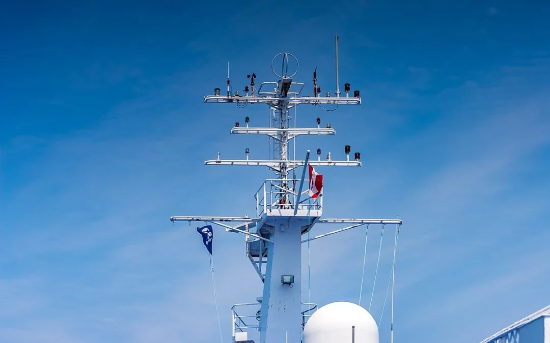
In the intricate world of maritime communication and navigation, the performance of marine antennas on commercial boats is a critical factor that directly impacts the safety and efficiency of operations. From selecting the right antenna type to proper installation techniques and regular maintenance, this blog post explores essential tips to ensure optimal performance and reliability for marine antennas on commercial vessels.
Importance of Marine Antennas on Commercial Boats
Marine antennas play a pivotal role in the communication and navigation systems of commercial boats. They facilitate the transmission and reception of crucial signals, including radar and radio communications, ensuring seamless connectivity for various maritime operations. Reliable antennas are the linchpin for effective communication, navigation, and safety at sea, making their optimization paramount for the maritime industry.
Selecting the Right Antenna Type
Choosing the right antenna type is the foundation for optimal performance. Factors to consider include:
Frequency Range: Different antennas are designed for specific frequency ranges. Select an antenna that aligns with the frequencies used for communication, radar, and other navigational purposes.
Antenna Gain: Antenna gain determines the directionality and range of signal coverage. Consider the operational needs of the vessel and select an antenna with an appropriate gain level.
Antenna Design: Antennas come in various designs, including omni-directional and directional. Omni-directional antennas offer 360-degree coverage, while directional antennas focus on a specific direction. Choose based on the vessel’s communication requirements.
Proper Installation Techniques
Even the best antennas can underperform if not installed correctly. Proper installation involves:
Mounting Location: Choose a strategic location for mounting the antenna that minimizes signal obstructions and interference. Ensure it is clear of other equipment that could impact its performance.
Cable Routing: Use high-quality coaxial cables and route them carefully to minimize signal loss. Avoid sharp bends and kinks in the cable, and keep it as short as possible to reduce attenuation.
Grounding: Proper grounding is crucial for antenna efficiency and safety. Follow manufacturer guidelines for grounding, considering the type of vessel and potential electrical interference.
Regular Maintenance Practices
Routine maintenance is key to keeping marine antennas in optimal condition:
Visual Inspections: Regularly inspect antennas for physical damage, corrosion, or loose connections. Address any issues promptly to prevent degradation of performance.
Coaxial Cable Checks: Examine coaxial cables for wear, damage, or water ingress. Replace any compromised cables to maintain signal integrity.
Cleaning: Keep antennas free from salt, dirt, and other contaminants. Regular cleaning with a mild detergent and fresh water prevents corrosion and ensures unobstructed signal transmission.
Avoiding Signal Interference
Signal interference can hamper the performance of marine antennas. Take steps to avoid common sources of interference:
Proximity to Metal Structures: Keep antennas away from large metal structures that can interfere with signals. Ensure antennas are mounted on non-metallic surfaces or use insulating materials.
Electronic Equipment Placement: Separate antennas from other electronic equipment to prevent electromagnetic interference. Maintain a distance to minimize the risk of signal disruption.
Weather Considerations: Adverse weather conditions, such as heavy rain or dense fog, can impact signal quality. Anticipate these conditions and take preventive measures or have alternative communication methods in place.
Utilizing Signal Boosters When Necessary
In areas with weak signals or challenging conditions, signal boosters can enhance antenna performance:
Amplifiers: Consider using signal amplifiers or boosters to strengthen weak signals, especially in remote or offshore locations.
Repeater Systems: Install repeater systems to extend the coverage range of marine communication signals, ensuring consistent connectivity in expansive maritime environments.
Consulting Experts: Seek guidance from marine communication experts, such as those available at www.tecomart.co, to identify the most suitable signal booster solutions for specific operational needs.
Ensuring Optimal Performance for Marine Operations
In conclusion, optimizing the performance of marine antennas on commercial boats is crucial for maintaining effective communication, navigation, and safety at sea. From selecting the right antenna type to proper installation, regular maintenance, and addressing signal interference, each step contributes to the overall efficiency and reliability of maritime operations.
Investing in high-quality marine radar and radio equipment, such as those available for sale at www.tecomart.co, coupled with adherence to best practices, ensures that commercial vessels navigate with confidence and resilience, even in challenging maritime conditions. By prioritizing the optimization of marine antennas, the maritime industry can uphold the highest standards of communication and safety at sea.
by Barani Chettiar | Mar 29, 2024 | Uncategorized
AIS in Maritime Collision Avoidance
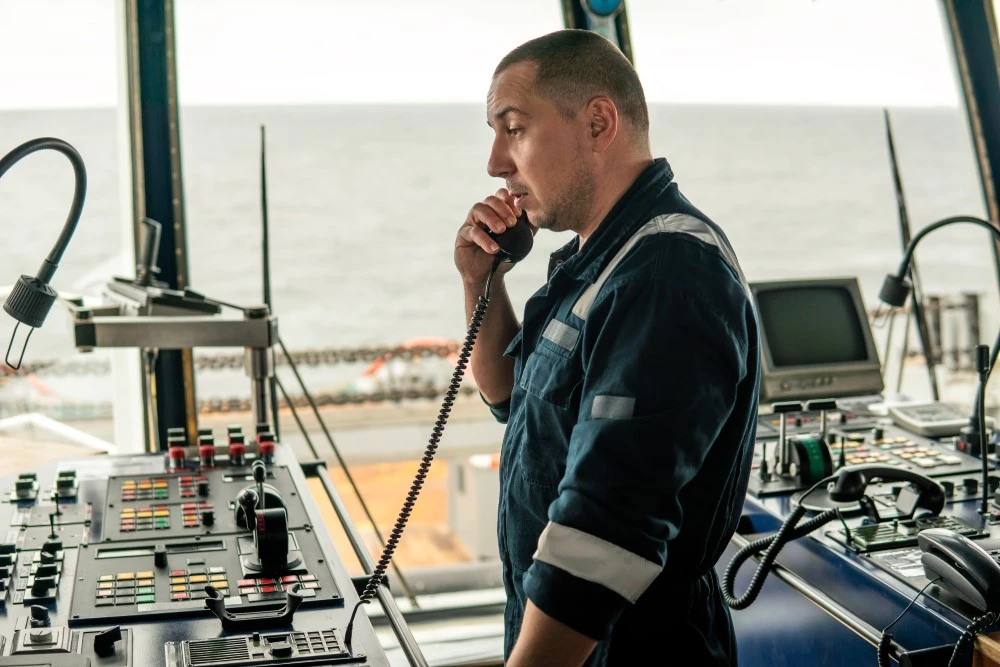
In the dynamic realm of maritime navigation, safety is paramount, and collision avoidance stands as a crucial aspect of ensuring secure voyages. The Automatic Identification System (AIS) emerges as a game-changer in this pursuit, revolutionizing collision avoidance strategies. This blog post aims to unravel the intricacies of AIS, its functionality, benefits, limitations, and the pivotal role it plays in enhancing maritime safety.
What is Automatic Identification System (AIS)?
AIS Overview
Automatic Identification System (AIS) is a globally adopted navigation technology that enables vessels to broadcast and receive real-time information about their identity, position, speed, and course. The system enhances situational awareness by facilitating communication between nearby vessels and shore stations.
Class A and Class B AIS Transponders
Class A AIS transponders are mandatory for vessels exceeding 300 gross tons or those engaged in international voyages. Class B AIS transponders, while not mandatory, are popular among smaller vessels and recreational boats. Both classes contribute to collision avoidance by broadcasting essential information.
How Does AIS Work for Collision Avoidance?
Vessel Identification
AIS enables vessels to continuously broadcast their identity, aiding in the identification of nearby ships. This real-time information exchange significantly reduces the risk of collisions by providing a comprehensive view of the maritime environment.
Collision Warning and CPA
Closest Point of Approach (CPA) and Time to Closest Point of Approach (TCPA) are crucial parameters calculated by AIS. These metrics offer vessels advanced warning of potential collisions, allowing for timely course adjustments and collision avoidance maneuvers.
Benefits of AIS in Enhancing Safety
Increased Situational Awareness
AIS contributes to heightened situational awareness by providing a comprehensive picture of vessel movements in the vicinity. Mariners can make informed decisions based on real-time data, minimizing the risk of collisions.
Streamlined Traffic Management
AIS supports efficient traffic management by enabling vessels to navigate through busy waterways with enhanced coordination. Ports and authorities can use AIS data to optimize vessel movements, reducing congestion and enhancing overall safety.
Limitations and Challenges of AIS
Signal Range and Obstructions
AIS signals are limited by the line-of-sight principle. Tall structures, geographic features, or adverse weather conditions can obstruct signals, potentially limiting the effectiveness of AIS for collision avoidance in certain scenarios.
Over-Reliance and Cybersecurity
Over-reliance on AIS without complementing it with other navigation methods poses risks. Additionally, cybersecurity concerns, such as AIS data manipulation, highlight the need for a holistic approach to maritime safety.
Integrating AIS with Other Navigation Systems
Radar Integration
Combining AIS with radar data enhances collision avoidance capabilities. Radar provides additional information on vessel movements and potential obstacles, complementing AIS data for a comprehensive navigation strategy.
Electronic Chart Display and Information System (ECDIS)
Integrating AIS with ECDIS allows vessels to visualize AIS data on electronic charts. This integration streamlines decision-making, offering a visual representation of the maritime environment.
Importance of AIS in Maritime Safety
In conclusion, the Automatic Identification System (AIS) stands as a linchpin in the pursuit of maritime safety, especially in collision avoidance. Whether you are exploring Class A AIS transponders or considering Class B options, www.tecomart.co offers a range of AIS solutions to meet your vessel’s needs. The integration of AIS with other navigation systems represents a holistic approach to maritime safety, ensuring vessels navigate the seas with heightened awareness and efficiency.
by Barani Chettiar | Mar 28, 2024 | Uncategorized
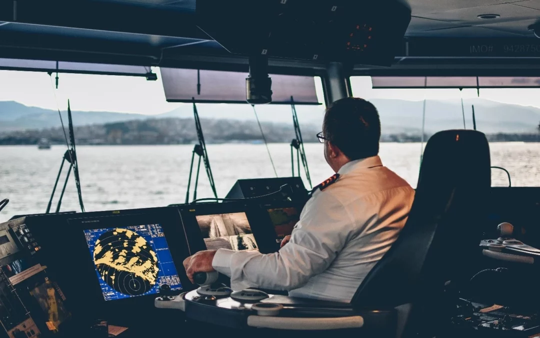
In the vast expanse of the open sea, precision and accuracy in navigation are paramount. Whether you are a seasoned sailor or a novice explorer of the waters, the reliance on advanced marine navigation equipment is indispensable. In this blog post, we will delve into the world of Marine GPS Systems, exploring their features, benefits, and how they contribute to enhancing navigation efficiency on the high seas.
Understanding Marine GPS Systems
Marine GPS Systems, short for Global Positioning System, have revolutionized the way we navigate on water. These systems utilize a network of satellites to provide accurate real-time positioning information. Unlike traditional nautical navigation equipment, GPS systems offer a global reach, enabling sailors to pinpoint their exact location anywhere on the planet.
Benefits of Using GPS for Navigation
Precision and Accuracy: The primary advantage of Marine GPS Systems lies in their unparalleled precision. Sailors can navigate with confidence, knowing their exact location, reducing the risk of getting lost at sea.
Global Coverage: Traditional nautical navigation equipment might have limitations, but GPS systems offer global coverage. Whether you are navigating the familiar coastal waters or venturing into uncharted territories, a GPS system ensures you stay on the right course.
Real-time Updates: With continuous satellite communication, GPS systems provide real-time updates on weather conditions, traffic, and potential hazards. This information is crucial for making informed decisions and ensuring a safe journey.
Features of Marine GPS Systems
Modern marine GPS systems come equipped with an array of features designed to meet the diverse needs of seafarers. From touch-screen interfaces to advanced route planning capabilities, these systems are a boon for anyone navigating the open waters. Some notable features include:
Chartplotting: Visualizing your route on electronic charts enhances situational awareness and allows for precise course plotting.
AIS Integration: Automatic Identification System (AIS) integration enables the tracking of nearby vessels, reducing the risk of collisions and enhancing overall safety.
Waypoint Navigation: Easily set waypoints to navigate specific routes or mark points of interest during your journey.
Enhancing Safety and Accuracy
Safety is a top priority at sea, and Marine GPS Systems play a pivotal role in ensuring it. The accuracy of these systems reduces the chances of accidental grounding or entering restricted areas. AIS integration further enhances safety by providing information about the movement and identity of nearby vessels, enabling proactive navigation decisions.
Tips for Optimizing Navigation Efficiency
Regular Updates: Keep your GPS system updated with the latest firmware and map data to ensure accurate information.
Backup Navigation: While GPS systems are highly reliable, having traditional navigation tools as a backup is a prudent practice, especially in case of technical failures.
Training and Familiarity: Invest time in understanding the features of your GPS system. Training and familiarity with its functions will boost your confidence and efficiency during navigation.
Conclusion: Embracing Technology for Seamless Navigation
In the ever-evolving landscape of marine navigation equipment, embracing the technology offered by Marine GPS Systems is a logical step forward. Whether you are in search of reliable marine radar for sale or other nautical navigation equipment, suppliers like www.tecomart.co provide a comprehensive range to meet your needs. The benefits of precision, global coverage, and advanced features make Marine GPS Systems an indispensable companion for sailors navigating the expansive and unpredictable seas. As we look to the future, integrating these advanced technologies into our maritime pursuits ensures safer, more efficient, and enjoyable journeys on the water.


